What you're seeing
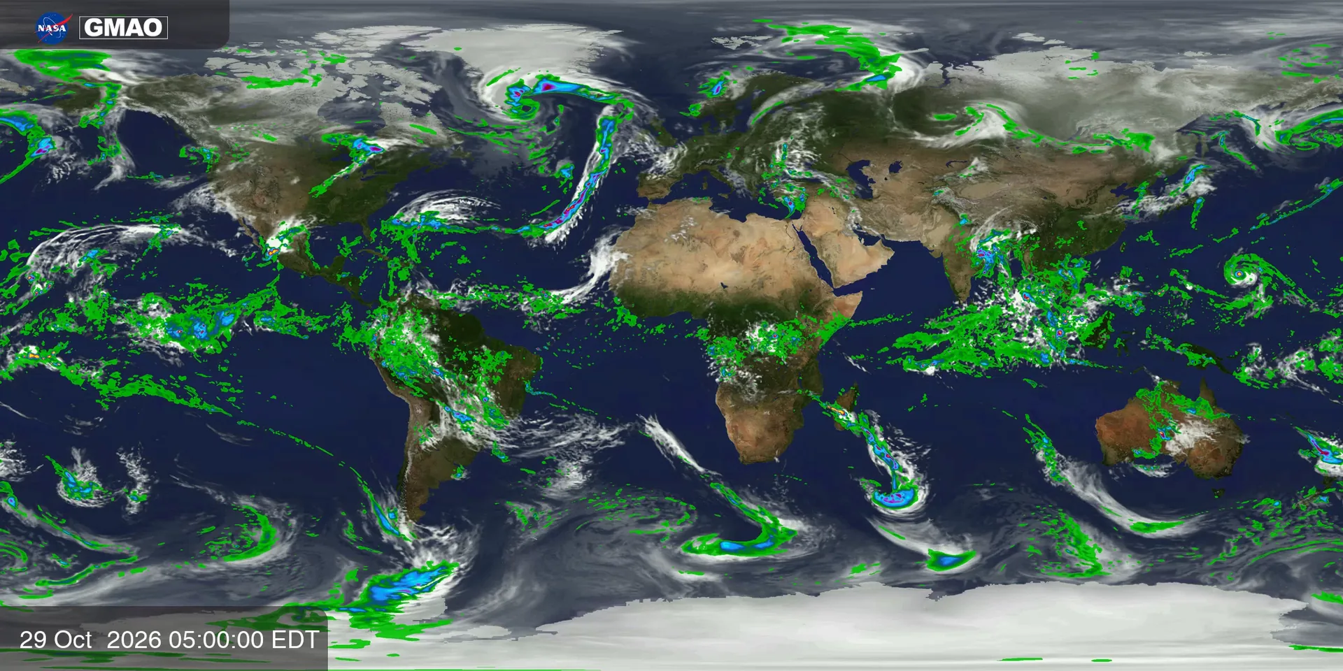
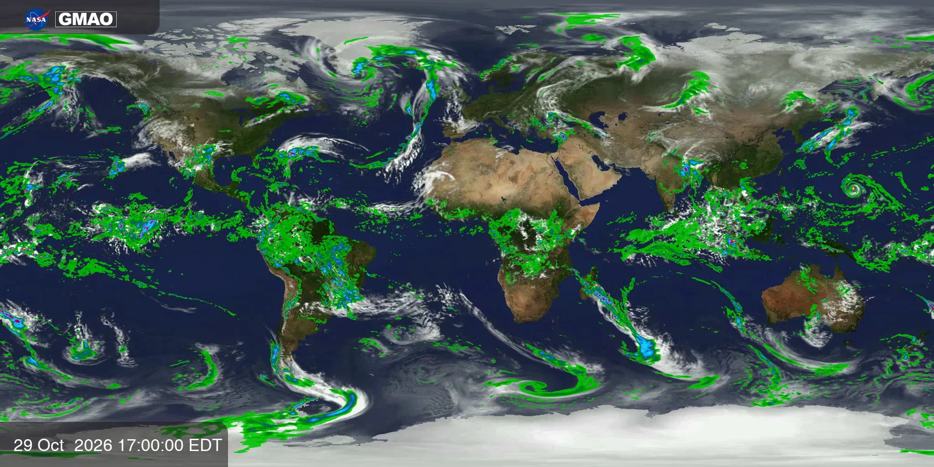
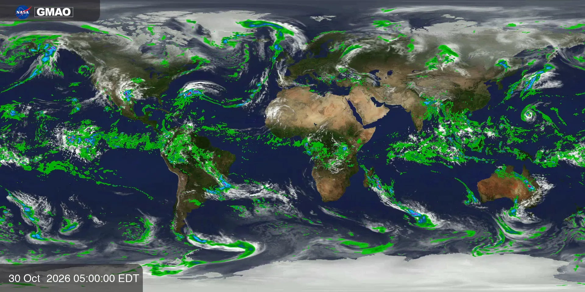
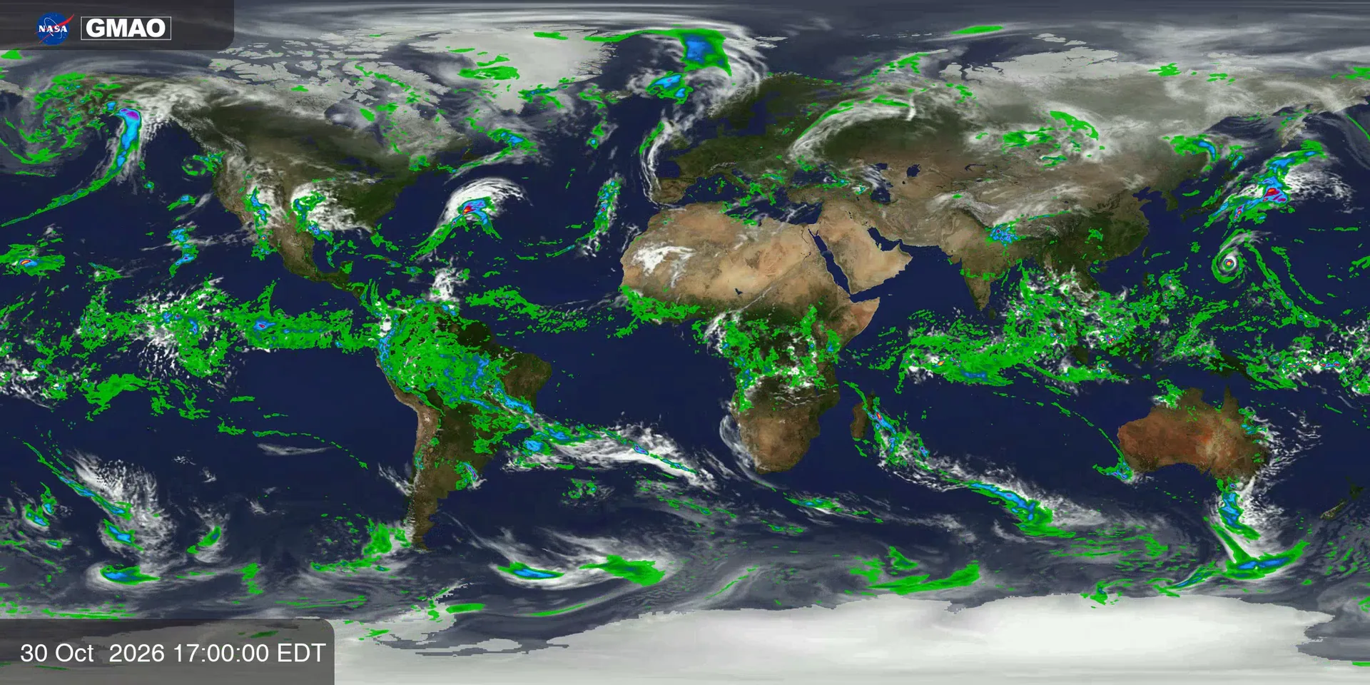
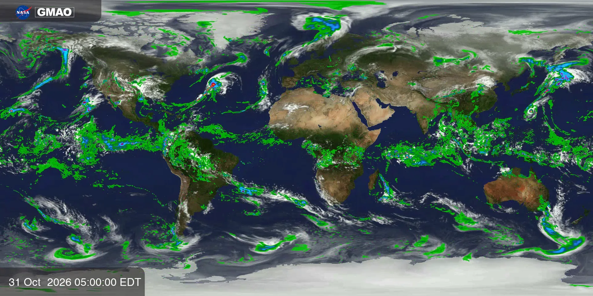
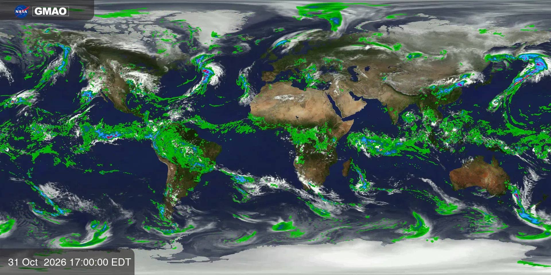
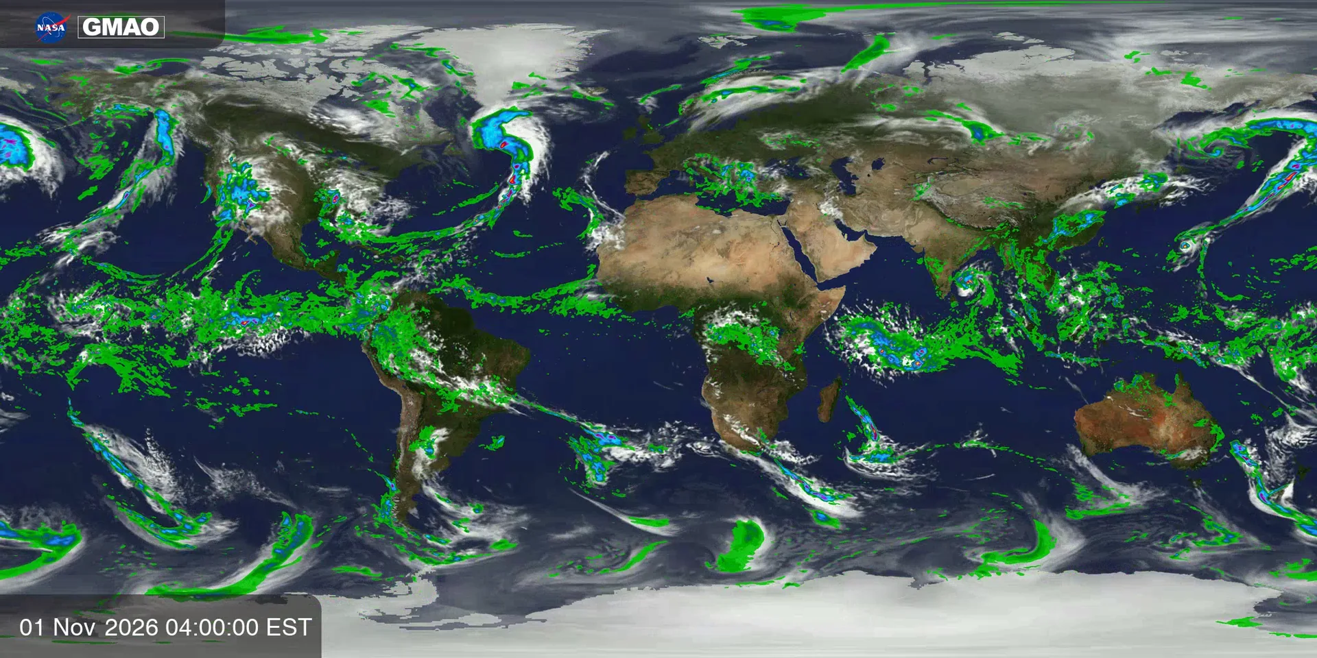
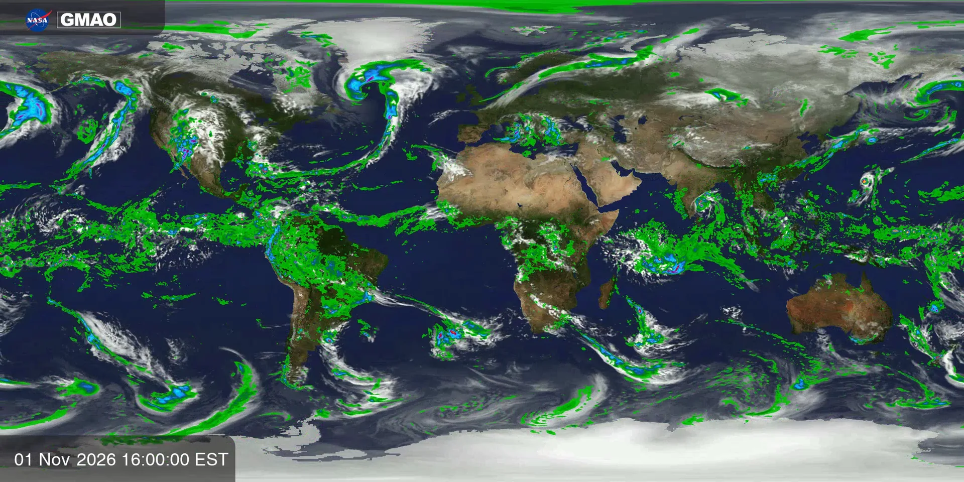
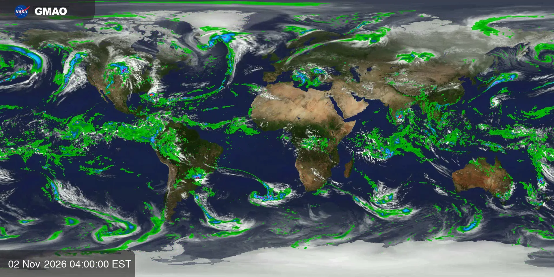
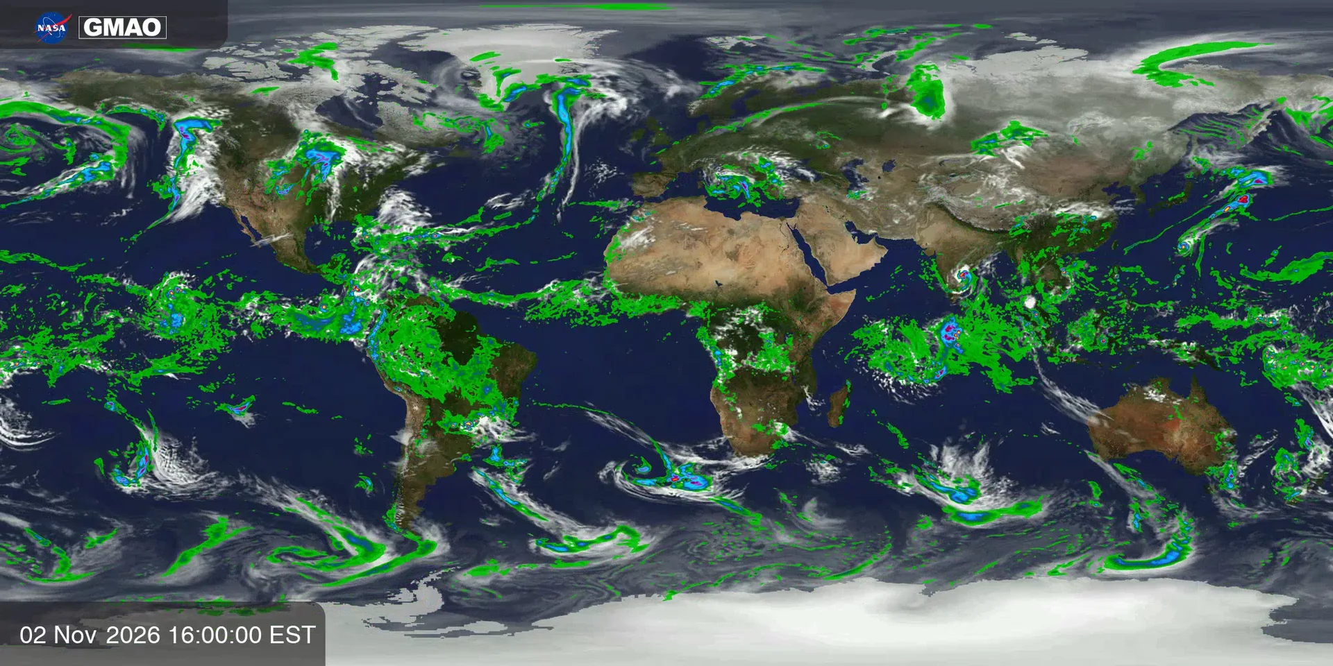
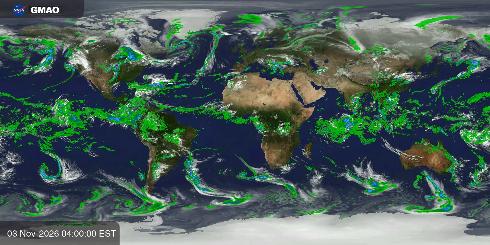
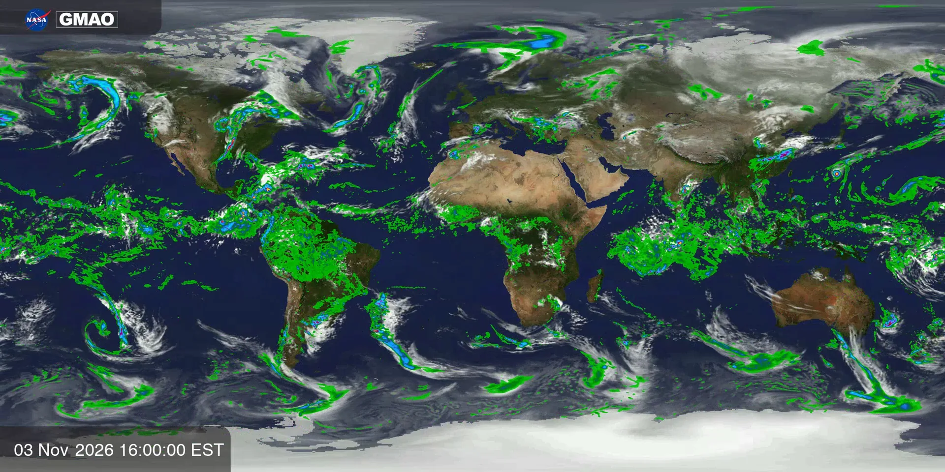
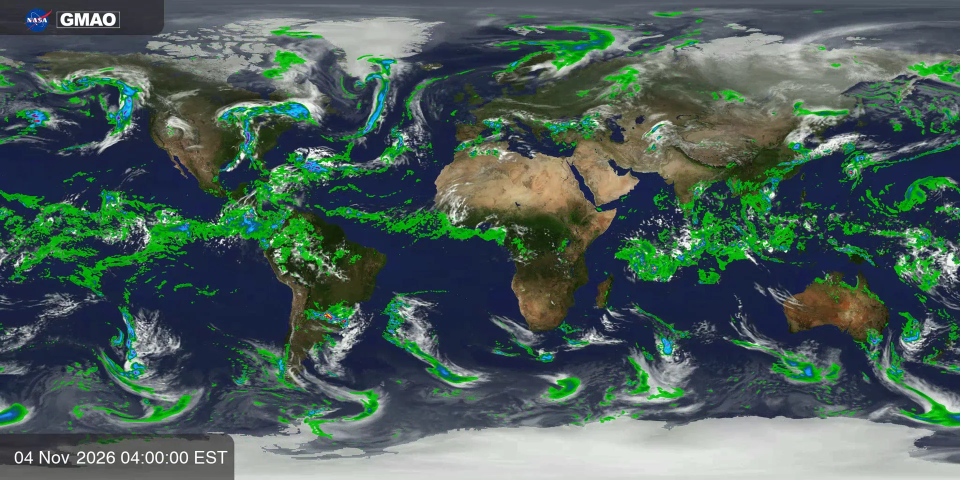
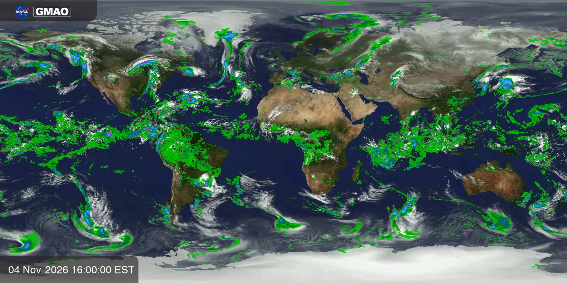
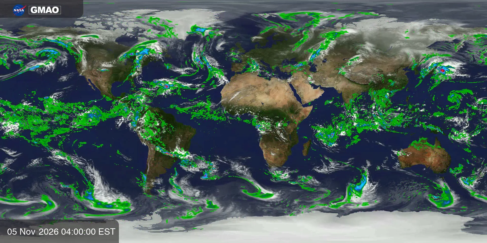
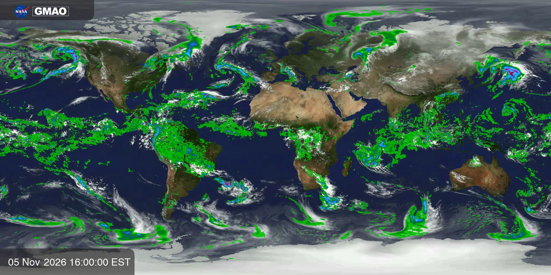
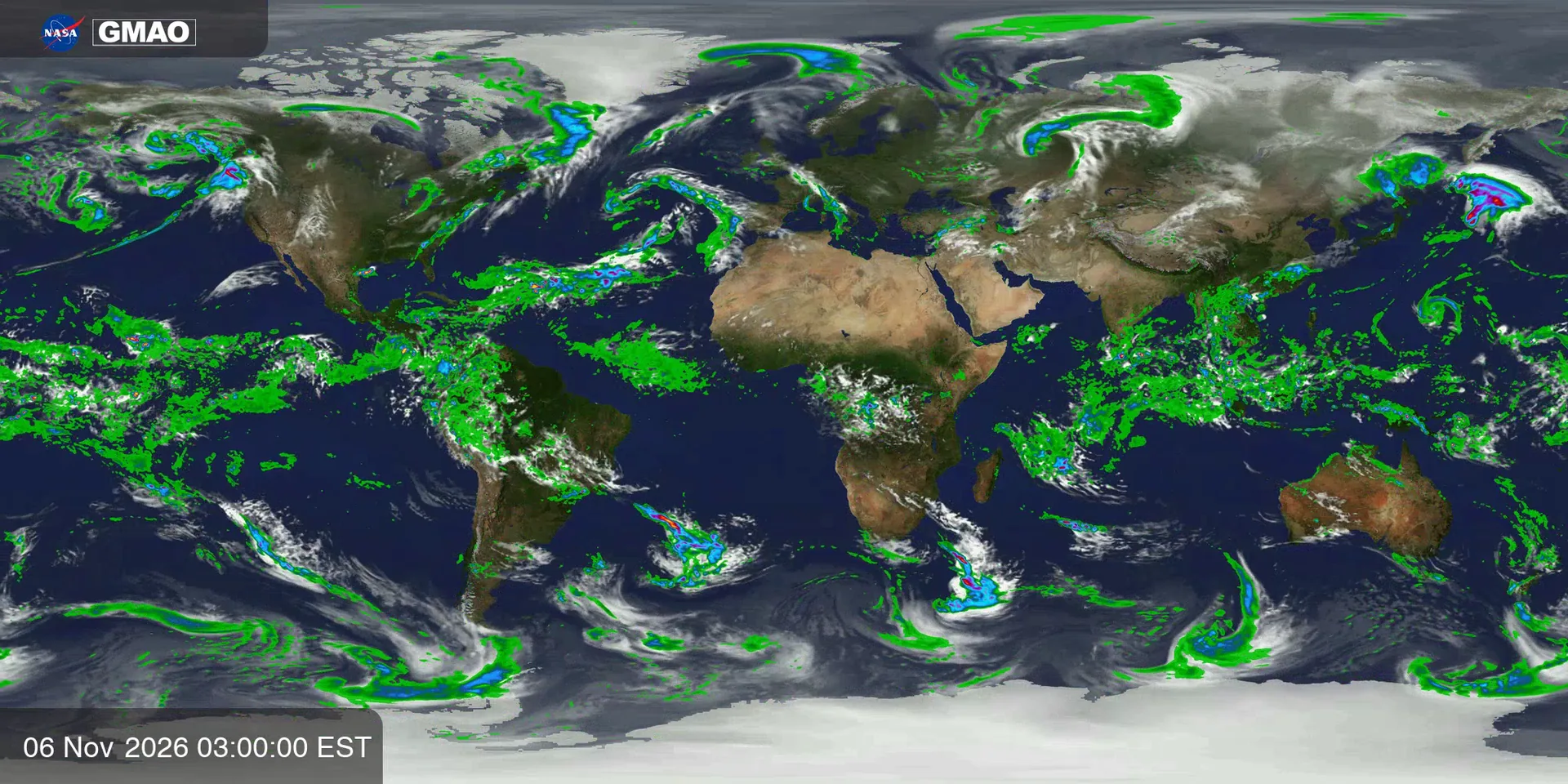
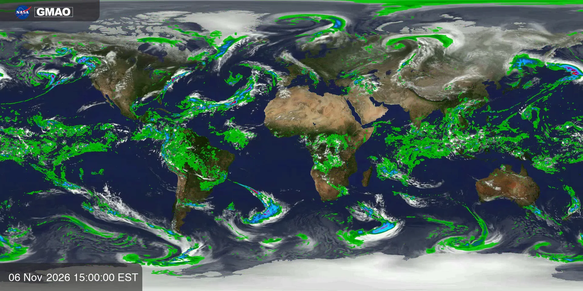
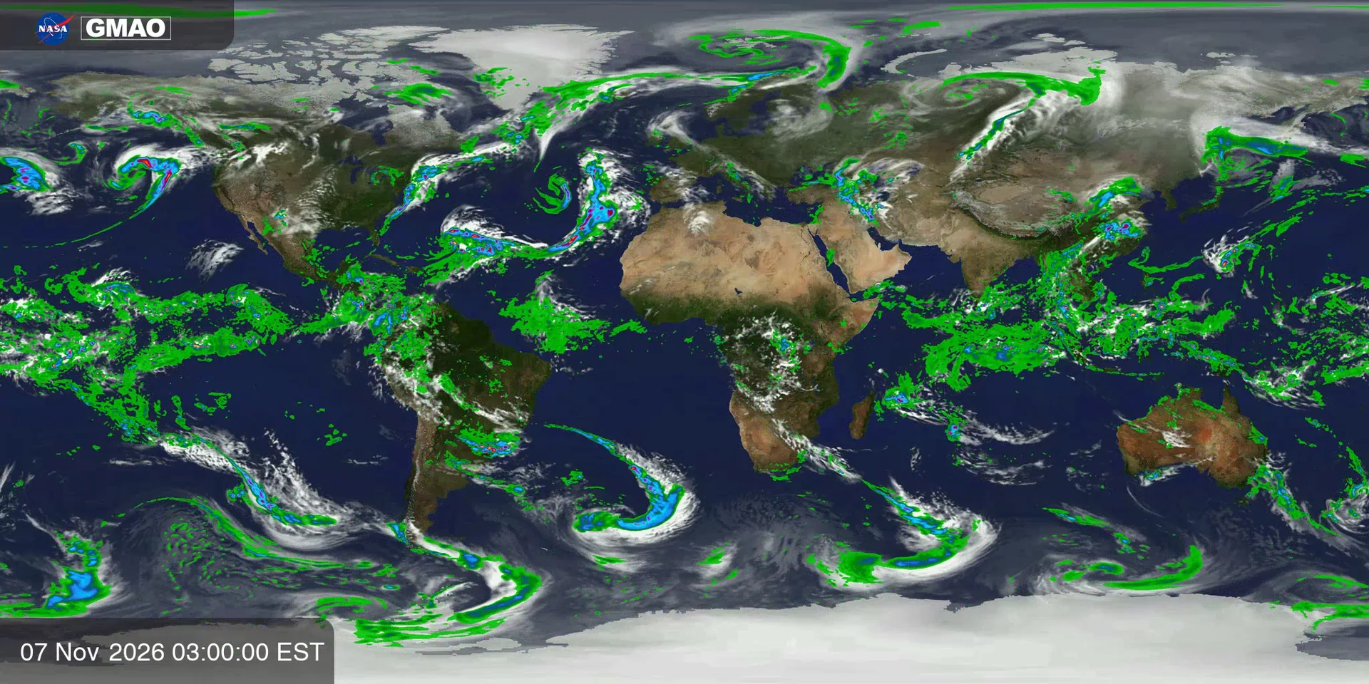
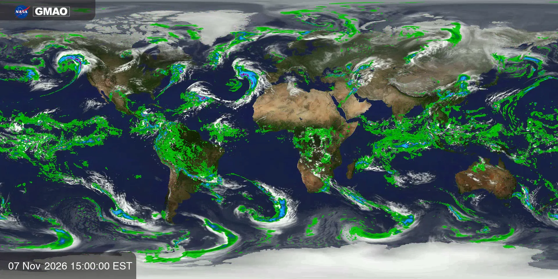
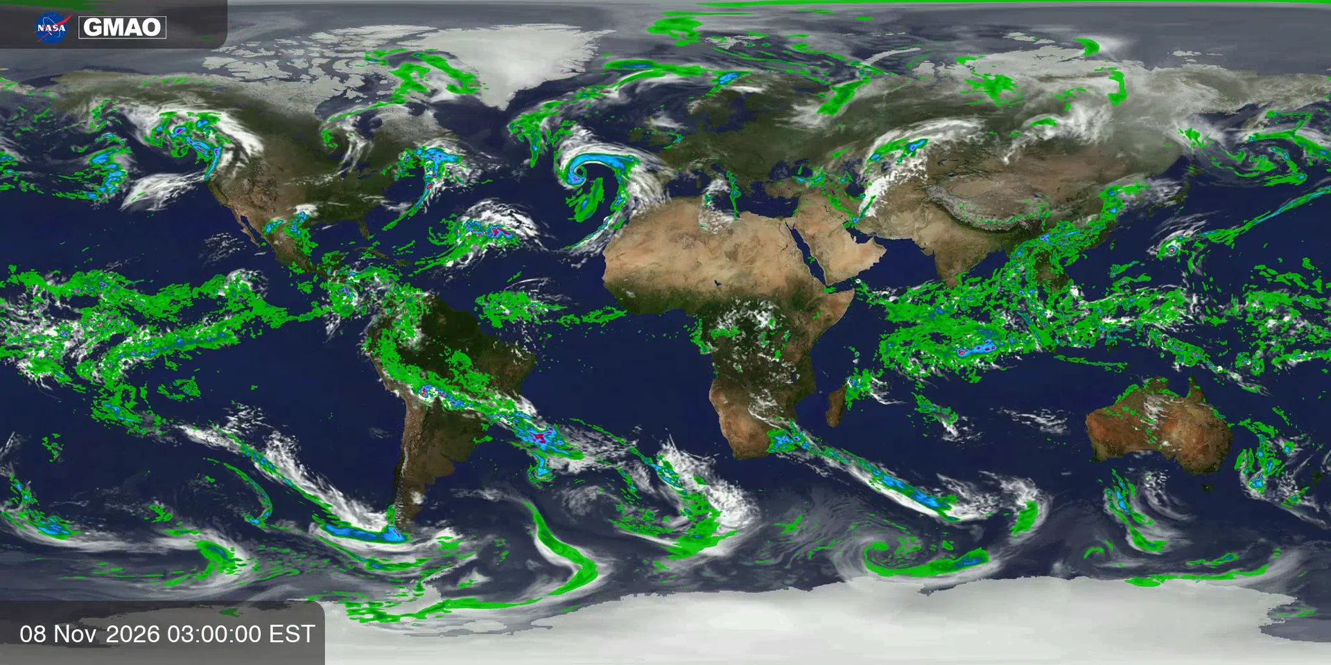
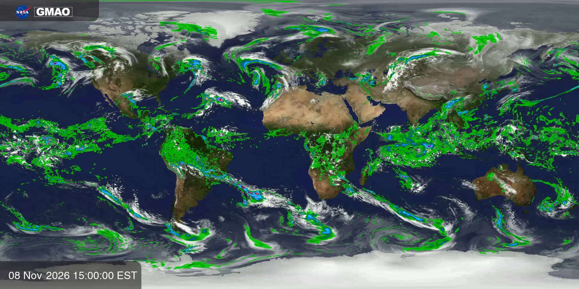
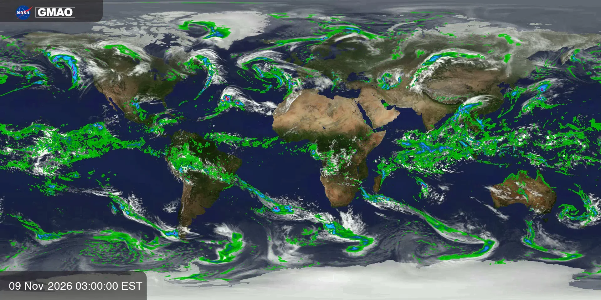
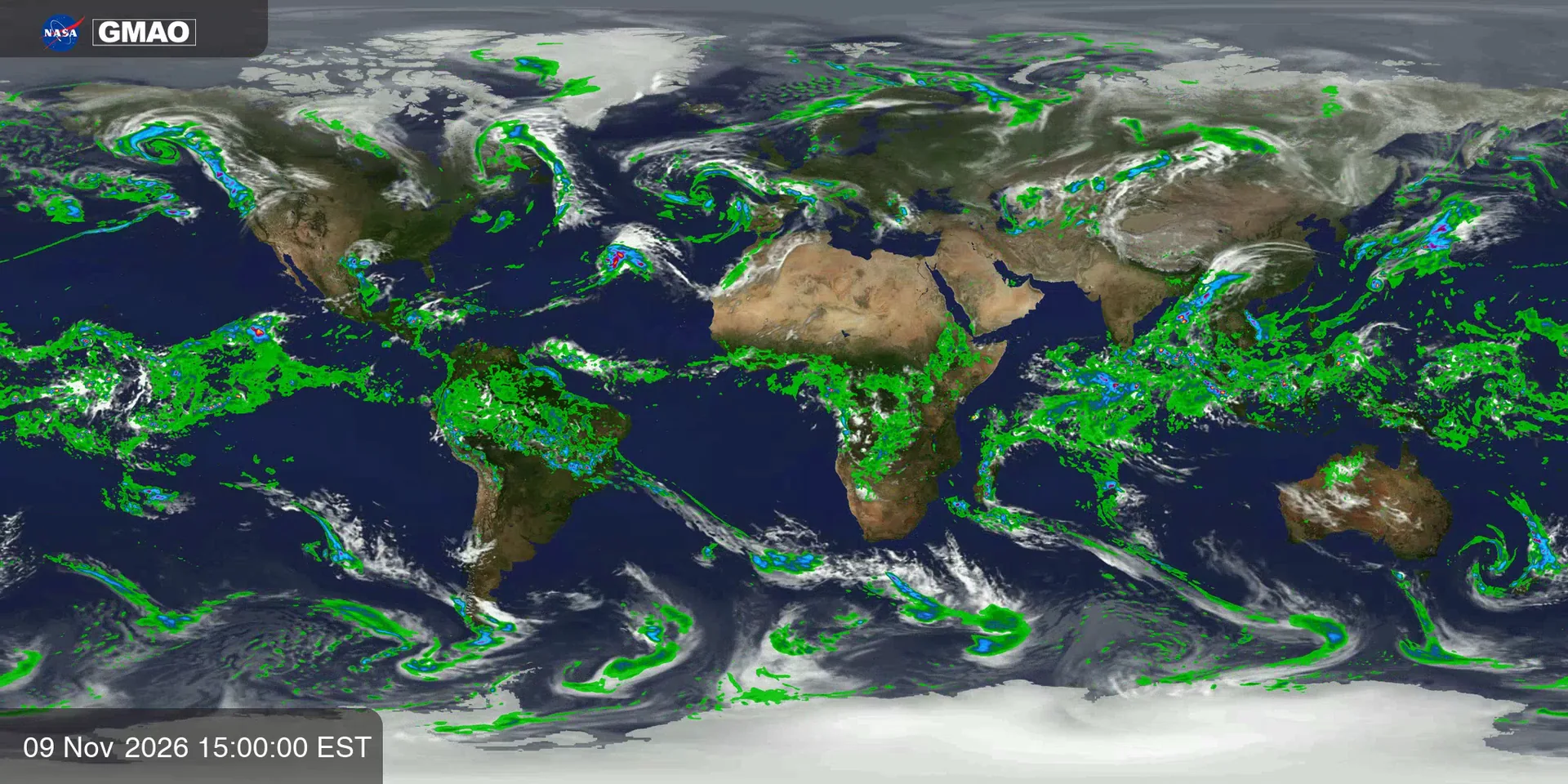
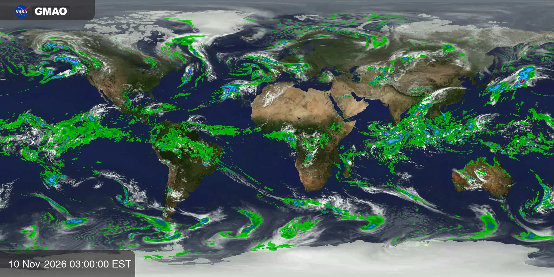
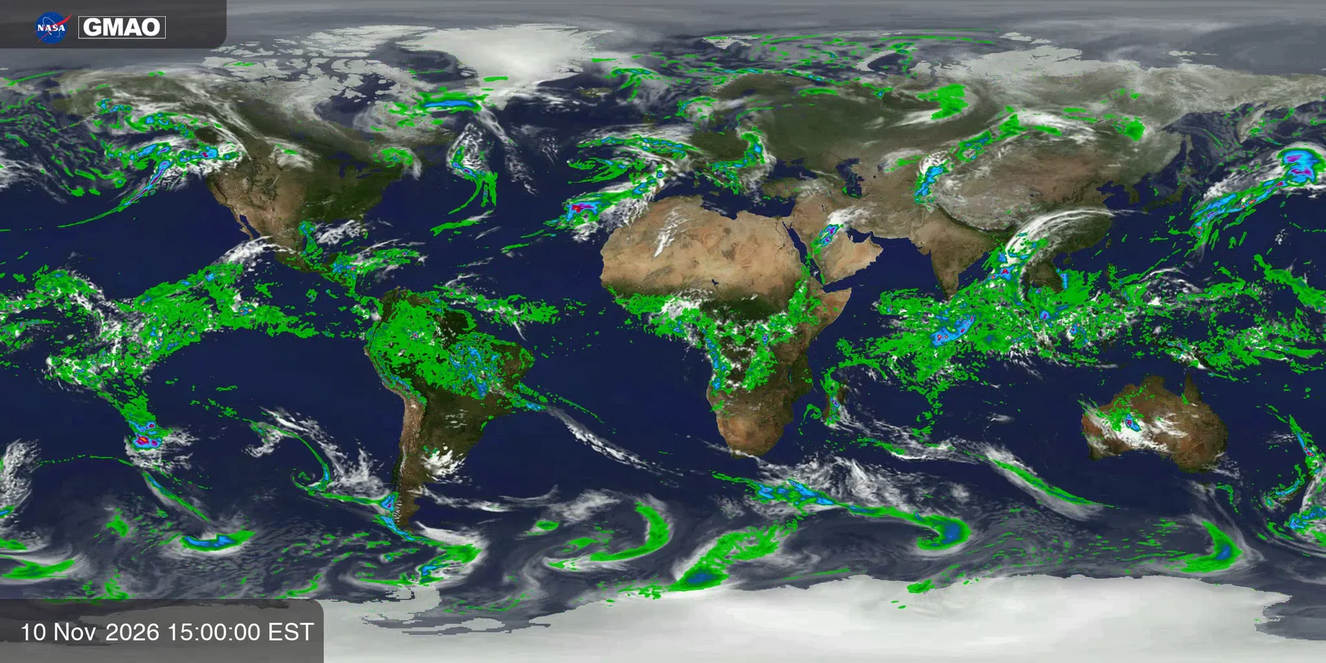
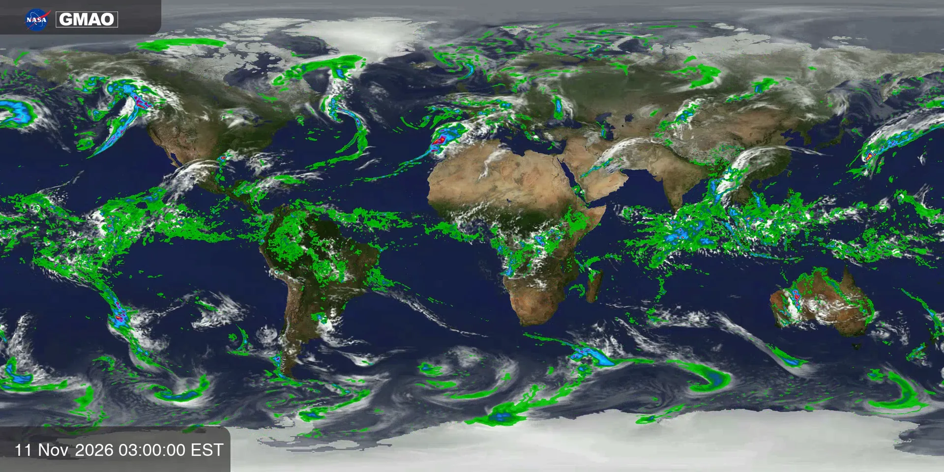
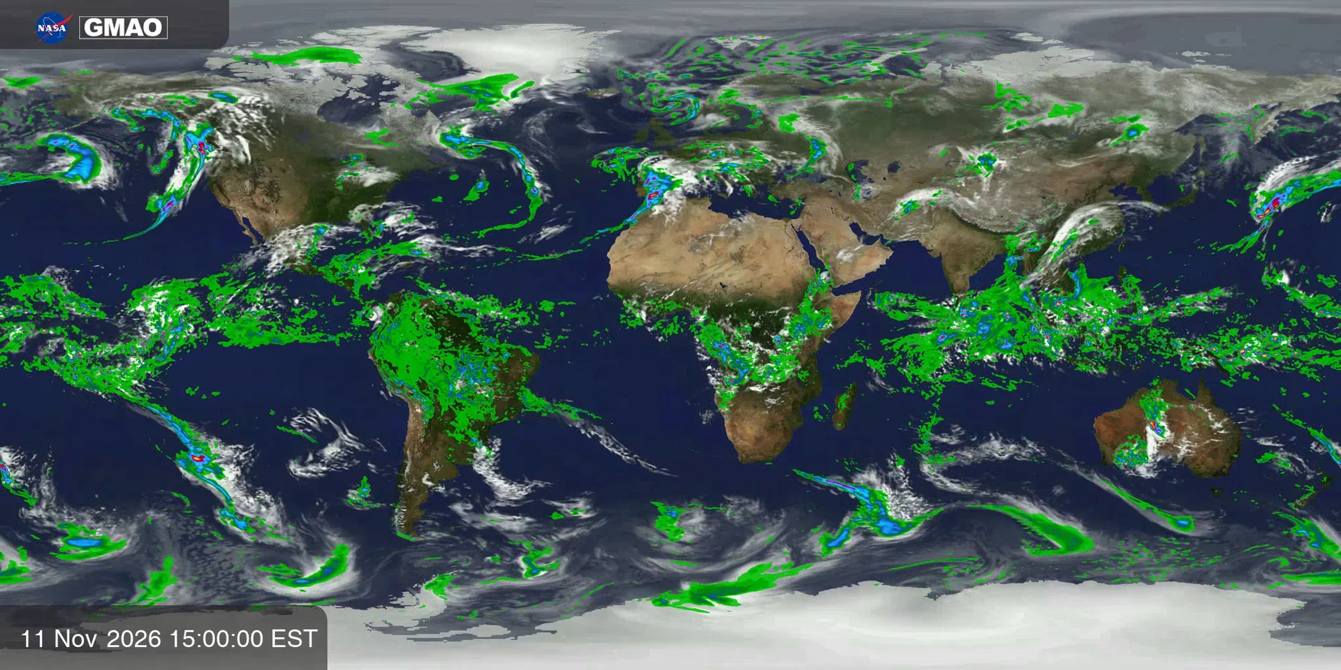
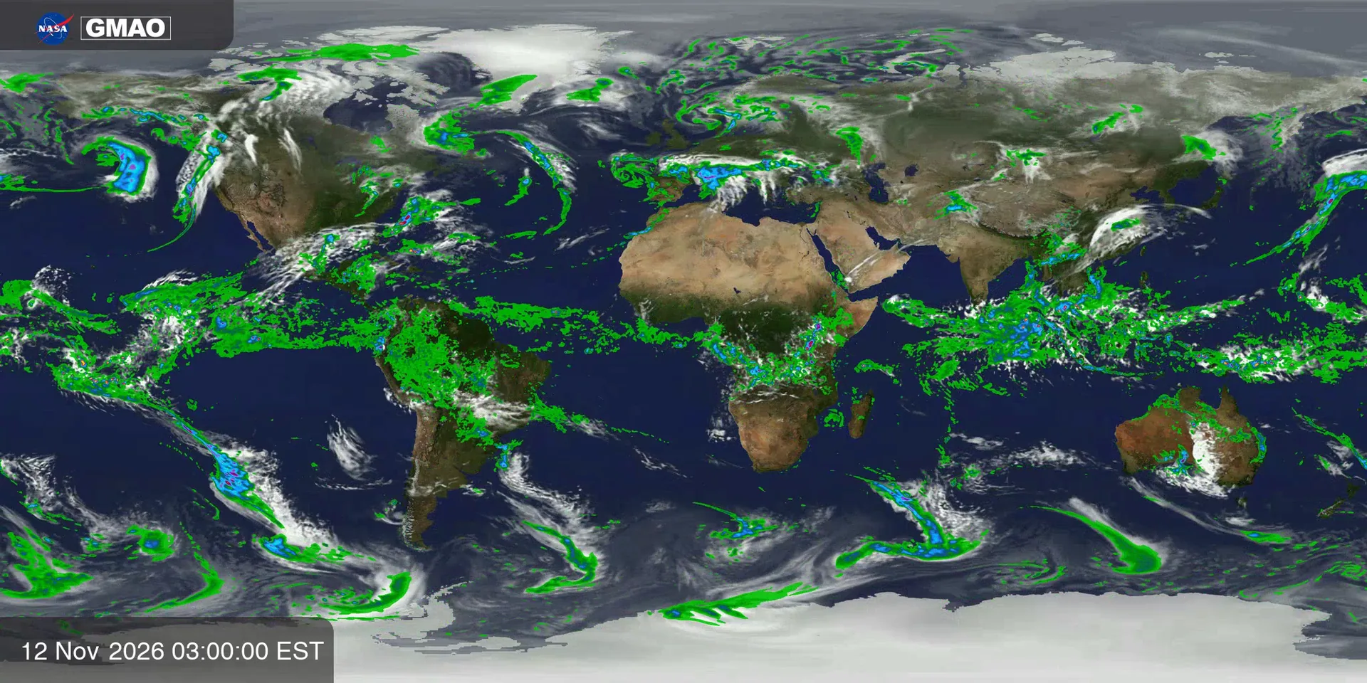
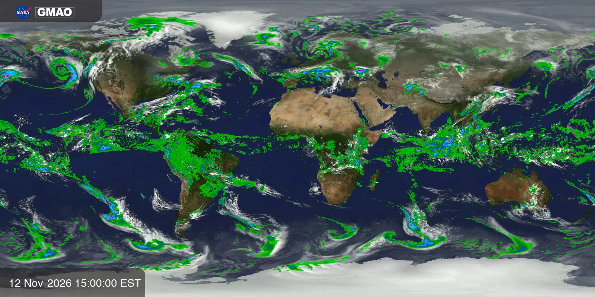
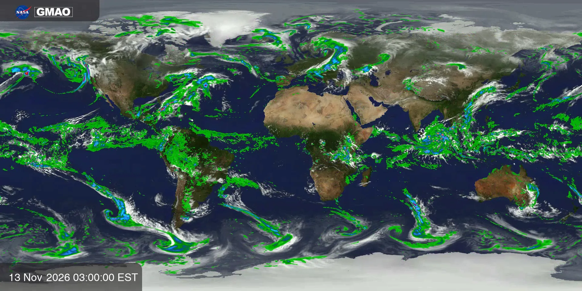
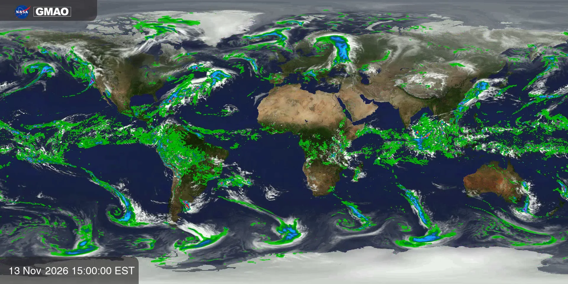
Precipitation (GEOS-FP)
Estimated precipitation drawn over clouds and terrain from NASA GEOS-FP model fields spanning about two weeks from late October to mid-November 2026. The color bar is an approximate 0 to 20 mm scale; the accumulation period is not stated on the source page.
Now: Frame 1, frame 1 of 32: lluvia intensa 0.00, lluvia moderada 0.02, lluvia 0.10, highest in Pacífico ecuatorial.
Source
NASA SVS 5149 · GEOS-FP Precipitation and Clouds
Topic: Water resources
This frame (mm)
- lluvia intensa0.00
- lluvia moderada0.02
- lluvia0.10
- Top regionPacífico ecuatorial · 0.25
What you hear
- Melody: Centro de la lluvia: nota más aguda = más al norte.
- Nature: earth rumble where the signal is over land, waves where it is over the ocean, rain and wind growing with lluvia intensa.
- Crystal bells: lluvia moderada.
- Left / right: where on the map the signal is centered.
Keyboard
- SpacePlay / pause
- ← →Previous / next frame
- SSound on / off
- ERadar on / off: it plays the data levels around a point of the map
- DDescribe the current frame
- ClickHear the place and its value on the map
- VVoice guide on / off
- MMap voice on / off
- EscClose panels
- Radar · ArrowsMove it; when you stop, you hear the place and its level
- Radar · Shift + arrowsMove it in bigger steps
- Radar · EnterRepeat where it is
- Radar · SpacePause or play the radar
- Radar · + / −Bigger or smaller area (also the mouse wheel)
- Radar · TabReach the radar controls